The Expedition
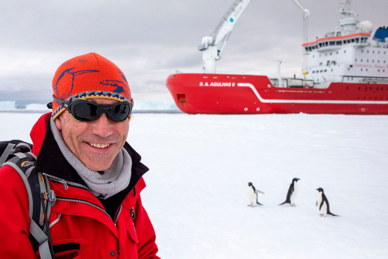
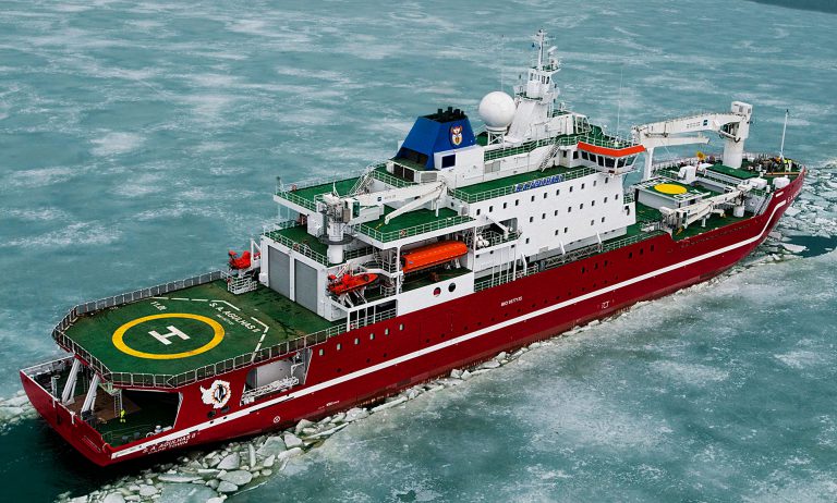
The Endurance22 expedition has brought together world-leading marine archaeologists, engineers, technicians, and sea-ice scientists on S.A. Agulhas II, one of the largest and most modern polar research vessels in the world.
Organised and funded by The Falklands Maritime Heritage Trust (FMHT), its aims were to attempt to locate, survey and film the wreck of Sir Ernest Shackleton’s ship Endurance, which was trapped and crushed by the ice and sank in the Weddell Sea in 1915.
This unprecedented 35-day mission navigated its way through the heavy sea ice, freezing temperatures and harsh weather of this extreme and forbidding environment, in a quest to be the first to successfully find the Endurance and survey the wreck using state of the art technology.
By uncovering vital new sub-sea data, the expedition hopes to improve our understanding of the Endurance, the sea ice in the Weddell Sea, and to use that knowledge to contribute towards the protection of the wreck. By telling the stories of this expedition and Shackleton’s expedition over one hundred years ago, it hopes to inspire young people about science, engineering, technology and exploration.
“After two years of meticulous planning for the new mission, I believe we have a great chance of finally finding the wreck deep under the ice of the Weddell Sea, but only by returning to the same spot will we know just how close we were to finding it previously. If we do locate Endurance, it will be a fantastic moment.”
Interview with expedition leader Dr. John Shears
As part of the Endurance22 education outreach programme, expedition leader Dr John Shears is interviewed, to give us an insight into what’s involved in planning the mission, the technology that will be used and what will happen during the expedition, which launches in February 2022.
“After two years of meticulous planning for the new mission, I believe we have a great chance of finally finding the wreck deep under the ice of the Weddell Sea, but only by returning to the same spot will we know just how close we were to finding it previously. If we do locate Endurance, it will be a fantastic moment.”
Navigating The Weddell Sea
Covering an area of approximately 2.8 million square kilometres between the South Shetland Islands and the continent of Antarctica, the Weddell Sea is among the harshest and most treacherous environments in the world.
Very few ships have ventured into the area in which the Endurance22 expedition has travelled, much of which is dominated by heavy sea ice and massive, permanent ice shelves. This is a forbidding and extreme environment that can only be reached by specialist ice-strengthened ships like the S.A. Agulhas II.

Endurance Search Area
The wreck lies under about 3,000 metres (9,843 feet) of water. Click the icon to find out more about the history of the Endurance.
1 of 1The Endurance Search Area
Crushed by the ice, the Endurance went down in 3000m of water on 21 November 1915. Because of overcast conditions, it was not possible to take their position by sextant on the day she sank. The precise location of the Endurance was, until now, unknown. The coordinates that were given by the ship’s captain, Frank Worsley, were an assumed position based on sextant observations that were taken the day after she sank and his estimates on the direction and speed of the ice drift since his last navigational sighting.
In their search for the Endurance the team’s archaeologists and navigational experts conducted a review of the errors and uncertainties that were inherent within Worsley’s coordinates, in particular with regard to longitude, which provided the best chance of locating the wreck.
Live Vessel Position
Expedition Route
Explore the route of the Endurance22 expedition vessel S.A. Agulhas II.
Can’t view the map? Click here
Vessel tracker by Big Ocean Data